

Creag na h-Eararuidh [Stuc na Cabaig]
Good walks are even better shared.
NN6819 : Part-frozen bog pool near the summit of Beinn Dearg
Alan O'Dowd Photo source
Overview
Creag na h-Eararuidh [Stuc na Cabaig]
Creag na h-Eararuidh, also known as Stuc na Cabaig, is an impressive Munro sitting majestically at 885 meters (2906 feet) in the breathtaking Scottish Highlands. A spectacular choice for hikers looking to escape the mundane, this mountain offers stunning views and a delightful challenge.
Geology
This majestic peak is mainly composed of schist and granite, creating a truly rugged landscape. Scattered boulders and rocky outcrops grace the summit, giving it a dramatic flair that is sure to capture the imagination. Be sure to bring a firm foot, as the terrain might feel like a rock concert at times!
The Routes
The primary route to ascend Creag na h-Eararuidh is the Coire nam Fuaran Route. This delightful walk spans approximately 10 kilometres and usually takes about 4.5 hours. While moderately challenging, the path will take you through lush glens and provide that rejuvenating sense of adventure. Along the way, expect to encounter panoramic vistas that are sure to leave you breathless (in the good way!)
Summit Features
Upon reaching the summit, you'll find a grand cairn and a trig point, both excellent spots for taking a break and snapping a memory or two. Looking around, you might just feel like the king or queen of the mountains.
Terrain Type
The terrain combines rocky sections with lush grassy patches, though hikers should prepare for a few boggy spots, particularly in the lower areas. Part hike, part dance, courtesy of the Highlands!
Views
From the summit, witnesses are treated to stunning views that include the mighty Ben Lomond to the south and the expansive Loch Awe to the north. For the view to be truly breathtaking, consider hiking in late spring or early summer, when the heather is in bloom and visibility tends to be at its finest.
Hazards
As with any Highland adventure, caution is advised; the weather can change in an instant, leading to quick adjustments in your plans. Some sections of the trail can become notably slippery during or after rainfall—so think of it as a nature-themed skating rink!
Nearby Summits
If you're feeling particularly adventurous, the nearby summits of Ben More (966 meters) and Stob Binnein (1165 meters) offer more breathtaking Highland experiences.
Access
Getting to Creag na h-Eararuidh isn't too tricky. Parking is available near the start of the Coire nam Fuaran trail; however, spaces are limited. For public transport enthusiasts, buses regularly serve Crianlarich, from where you can take a short taxi ride to the trailhead. The town of Crianlarich has amenities including cafes and shops to stock up on supplies, so you're not left in rumbles on your hike.
Facilities
Crianlarich has a few cafes, a small shop, and public toilets available, providing that much-needed rest stop before or after your hike.
History
The name Creag na h-Eararuidh translates as ‘Rock of the Yellow Hills,’ likely inspired by the heather blooms that dot the landscape. Historically significant, the mountain and its tales are entrenched in Gaelic folklore, making it an intriguing visit for those who love a good story!
...Now that you're armed with information, lace up those hiking boots and set forth—Creag na h-Eararuidh awaits! Happy hiking!
Explore routes near Creag na h-Eararuidh [Stuc na Cabaig]
Walks starting near this hill. Open a route to check its map, distance and full itinerary.
Loch Lubnaig: West Shore Railway Path from Ben Ledi Car Park
View route
Crieff: Lady Mary's Walk and the River Earn
View route
Killin: Falls of Dochart, Finlarig and Moirlanich Longhouse
View route
Loch Katrine: Brenachoile Point Shore Walk from Trossachs Pier
View route
Route planning notes
These notes describe possible approaches. Check a route's map and access information when planning your walk.
Coire nam Fuaran Route
This route meanders through a scenic glen before ascending to the summit, offering breathtaking views of the surrounding landscape.
Make a day of it, together
Find someone to share the walk with, or organise a day out along a route you like.
Photo Gallery
View all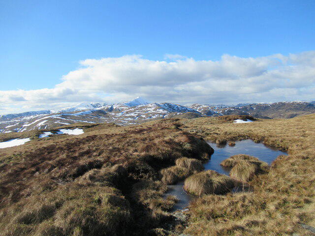 Photo could not load
NN6819 : Part-frozen bog pool near the summit of Beinn Dearg
Alan O'Dowd
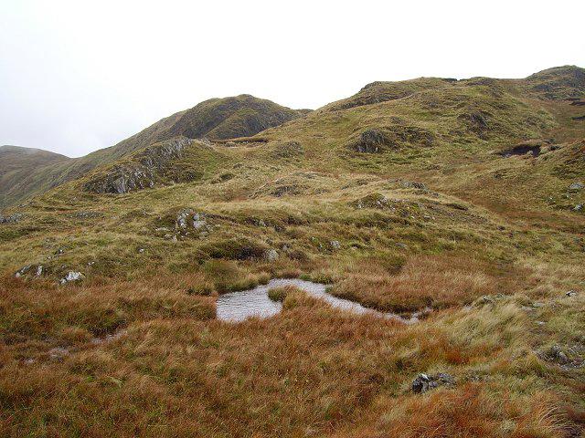 Photo could not load
NN6819 : Beinn Dearg
Richard Webb
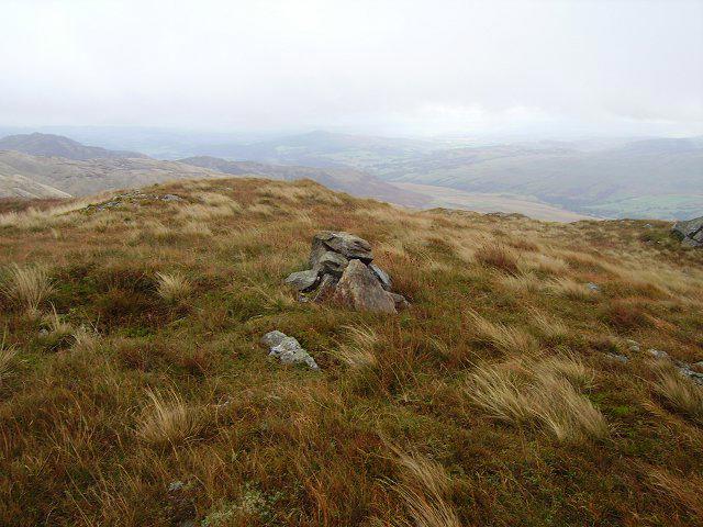 Photo could not load
NN6819 : Beinn Dearg
Richard Webb
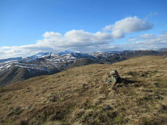 Photo could not load
NN6819 : Western top of Beinn Dearg
Alan O'Dowd
Hill facts and local notes
Classifications
Elevation
708m
2,324 ft
Prominence
353m
Coordinates
56.3450, -4.1290
NN685190
OS Map
57
Explorer: OL47W 368W
At the Summit
The summit features a large cairn and a trig point, providing a perfect spot for that all-important selfie!
Terrain & Geology
The mountain is primarily comprised of schist and granite, which gives it a rugged appearance. Large boulders scattered at the summit add to its dramatic character.
Views & Scenery
From the summit, you can see Ben Lomond to the south and vast stretches of Loch Awe to the north.
History & Heritage
Name Origin
Creag na h-Eararuidh translates from Gaelic as 'Rock of the Yellow Hills', possibly referring to the area's heather.
Historical Significance
The mountain is popular amongst hikers and has been part of traditional Gaelic folklore, with tales of spirits said to roam the highlands.
Getting There & Facilities
Parking
There is limited parking at the start of the Coire nam Fuaran trail, adequate for a few vehicles.
Public Transport
Buses run from nearby towns to the village of Crianlarich, followed by a short taxi ride to the start of the trail.
Nearby Facilities
Crianlarich has a couple of cafes, a shop for supplies, and public toilets.
Safety Information
Known Hazards
- Be wary of sudden weather changes; conditions can shift rapidly in the Highlands. Some sections can be slippery, especially after rain.
General Safety Tips
- Check weather conditions before setting out
- Carry appropriate clothing and equipment
- Let someone know your planned route
- Take a map, compass, and GPS device
- Carry emergency supplies: food, water, first aid kit, torch
Hills
Some common questions about the hills answered
Are there group walks up Creag na h-Eararuidh [Stuc na Cabaig]?
Many walkers use Walkmates to join or organise walks with others. You can check for group walks around Creag na h-Eararuidh [Stuc na Cabaig] through the maps
Are there other walkers around Creag na h-Eararuidh [Stuc na Cabaig]?
Activity varies by location and time, but Walkmates lets you see whether others have shared walks or shown interest in this area. Find other people through the walking friends search walking friends for Creag na h-Eararuidh [Stuc na Cabaig] search or of course create your own walk for Creag na h-Eararuidh [Stuc na Cabaig]
Can I organise a walk to Creag na h-Eararuidh [Stuc na Cabaig]?
Yes. If there aren’t any walks listed already, you can create a walk and make it available for others to join.
If you're signed up to Walkmates, you can create a walk to Creag na h-Eararuidh [Stuc na Cabaig].
How do I find a walk up this hill?
There are often multiple ways to walk this hill, depending on experience and route preference. Walkmates helps you explore walks and routes that others have shared.
Can I suggest a new route up Creag na h-Eararuidh [Stuc na Cabaig]?
Yes. You can suggest or create routes to share with others. Walkmates focuses on the social side of walking, so routes are used to help people organise walks and explore areas together, rather than as detailed navigation tools or route libraries.
Other uses really appreciate knowledgeable walkers sharing their routes. Share your favourite route to Creag na h-Eararuidh [Stuc na Cabaig] here
The is an error or something incorrect about this hill. How do I let you know?
We always strive to keep the information on Walkmates as accurate as possible. If you find an error, please let us know through the contact form and we'll aim to correct it as quickly as possible
Community Discussion
Comments
Location
![Creag na h-Eararuidh [Stuc na Cabaig] location map](https://cdn.walkmates.com/hill-maps/hill-sources/3937/56.34503_-4.12896.png)
Grid reference: NN685190
View on OpenStreetMapOpens a map in a new tab, centred on the hill.


No comments yet. Be the first.